
Fit once
A small, removable logger is fitted to a vehicle already travelling local roads. There is no camera or specialist survey equipment.
Road-condition intelligence for local authorities
RoadPulse combines very low-cost passive sensing with existing condition surveys and roadworks records—giving councils and elected members a living view of coverage, condition and change.
Built to complement—not replace—SCANNER, PAS 2161, AI surveys or established safety inspections.
01 No cameras or personal data
02 No specialist survey vehicle
03 Rapid collection at traffic speeds
04 Survey and roadworks data included
The approach
The principle is simple: fit a very low-cost logger to an ordinary vehicle and let it collect during normal journeys. RoadPulse turns repeat coverage into useful evidence between periodic surveys.
A small, removable logger is fitted to a vehicle already travelling local roads. There is no camera or specialist survey equipment.
The logger auto-calibrates and records road response at normal traffic speeds, without adding work for the driver or council.
Observations are aligned to PMS segments and enriched with existing survey history and roadworks records.
Building network coverage
Phase 1 indicates that useful coverage depends on more than vehicle numbers. The strongest mix combines sufficient mileage, varied routes, regular movement at traffic speeds and natural access to local and unclassified roads.
RoadPulse’s collaboration with a major national delivery company is expected to generate extensive, repeated observations across residential and local roads.
Council vehicles reach different destinations and can complement delivery routes, improving coverage across the authority without creating additional journeys.
Already covered for formal surveys?
RoadPulse does not ask a highways team to replace SCANNER, PAS 2161 reporting, AI surveys or professional inspections. It extends intelligence across local and unclassified roads that formal surveys may reach less frequently, between scheduled survey cycles.
What visibility do you have across the rest of the network, between surveys, without sending anyone out to collect it?
High-quality SCANNER, AI and inspection data provides the reference evidence needed to test RoadPulse rigorously. Phase 2 can compare the datasets, establish where passive inertial monitoring adds useful frequency or coverage, and identify where it does not.
From data to decisions
RoadPulse is being developed to identify change, rank the strongest signals and produce a manageable review list—helping limited inspection and maintenance resources focus on the places most worth investigating.
The value is turning wider, more frequent coverage into a focused and explainable shortlist for professional review.
Use repeatable evidence to focus inspections, surveys and analysis where signals are strongest.
Ward-level reporting and consistent PMS references support clearer priority-setting and conversations with officers and residents.
Track deterioration and compare condition before and after recorded roadworks to strengthen maintenance plans and future funding cases.
Create clearer summaries of network coverage, priorities and change—without presenting sensor events as confirmed potholes.
Phase 1
RoadPulse is approaching the end of its initial development trials. Working with Coventry City Council, Phase 1 has tested the collection model and the way observations can be translated into practical local reporting.
RoadPulse is also collaborating on a pilot with a major parcel-delivery company. Selected delivery vans will contribute road observations during routine journeys—exploring how existing commercial fleets can increase repeat coverage without additional survey journeys or data-collection effort.
Explore the benefits for fleet operatorsCoventry is RoadPulse’s development and reference partner. The information is indicative and remains subject to professional review.
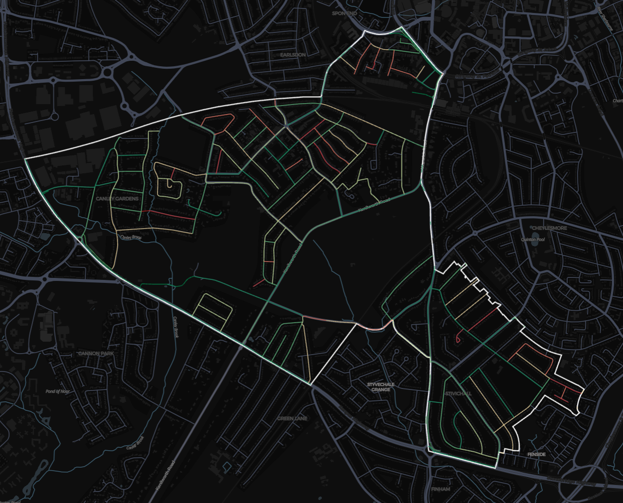
Earlsdon report dated 15 September 2026. Comparison uses the RCI data uploaded and successfully mapped in RoadPulse; it does not represent survey information held elsewhere by the authority.
A concise ward-level overview for elected members and officers.
A transparent ranked list with component scores, confidence, policy weightings and links to each PMS segment.
Toggle harsh response, sustained vibration, coverage, freshness and available survey context in Kepler.
RoadPulse flags patterns for review. These are triage indicators—not engineering findings, confirmed safety defects or statements that a repair is required.
Invitation to shape Phase 2
Phase 2 will focus on measuring deterioration over time, testing earlier warning signals and turning the strongest changes into a manageable review list for councils.
Over time, a proven history of repeat observations could also support more predictive maintenance planning. That is a longer-term ambition, not a current claim.
We are inviting a small number of councillors to lead trials within their authorities. This is an opportunity to influence the next stage of development—not a procurement or sales approach.
Discuss a Phase 2 trialHow a trial would work
The principal contact, helping shape information for scrutiny, local priorities and resident discussions.
Provide operational input so the trial fits established systems, professional practice and reporting needs.
Supplies and supports collection, aligns outputs to PMS segments, and develops the maps, reports and trend intelligence.